Trending Topics

 Trending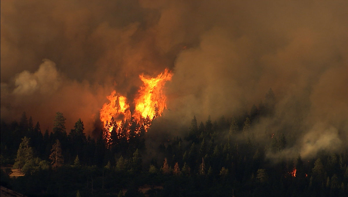
How FireSat’s AI-driven satellites are changing wildfire detection

Wildfires are escalating in frequency and intensity, posing unprecedented threats to communities and ecosystems worldwide. As climate change accelerates, the need for rapid, accurate wildfire detection has never been greater.
Enter FireSat, an initiative led by the non-profit coalition Earth Fire Alliance. Don’t worry if you haven’t heard of them: it was only founded last year, with the stated aim of creating “accessible fire data from and for the entire planet”.
FireSat is designed to revolutionise emergency responses and save lives and communities, which sounds great. But what makes FireSat so much more effective than current detection systems? And how does AI play a pivotal role in this technological leap? That’s what this article explores.
What is FireSat?
FireSat is here to improve the early detection of wildfires around the globe. In time, the aim goes, FireSat will consist of around 52 low-earth orbit satellites, collecting data before, during and after a wildfire.
FireSat claims to raise the alarm whilst wildfires are around 400 times smaller than the size that would trigger current satellite detection technologies. To give you an idea of scale, the current early detection satellites can detect fires of around 2–3 acres. FireSat can spot a fire which is roughly 5 x 5 metres, which equates to the size of an average bedroom in a family house.

FireSat’s first satellite was launched earlier in this year. When the full constellation of FireSats are launched and operational, the high-resolution imagery will be refreshed every 20 minutes, opening the opportunity for much faster response times from teams back on earth.
One of the improvement drivers of this technology is Google’s AI.
How does AI detect wildfires?
The image quality of the current detection satellites aren’t of high enough resolution. By the time the current system detects a wildfire event, it will already be a substantial size.
FireSat’s higher resolution cameras and sensors radically improve the quality of the images taken before AI steps in for image analysis. The AI not only compares the current image to those taken previously, but can incorporate factors such as weather, landscape and physical infrastructure to decide if a wildfire has started.

Google has history in using AI to help assist with wildfires. Since 2020, it has combined satellite data with AI to create wildfire boundary maps that give information to users via push notifications. Google now covers 15 countries across the US, Europe and Africa.
There can be little doubt that this technology can save lives. In the first week of July 2020 alone, 1.4 million people saw vital information after wildfires began in Europe and Africa.
Is FireSat a Google product?
No, but Google is a key partner to the Earth Fire Alliance and FireSat is its flagship program. Other partners include satellite specialists MuonSpace, the Environmental Defense Fund and the Gordon and Betty Moore Foundation. If Gordon’s name has a ring of familiarity to it, that’s because he co-founded Intel.
Are wildfires really increasing in frequency?
Yes. One of the many effects of human-driven climate change is a significant increase in wildfires. In 2024, the Copernicus European Forest Fire Information System (EFFIS) reported that the EU’s total burned area on average 9% higher than the records for 2006 to 2023. Fires larger than 30 hectares were up 51%.
In 2024, the National Interagency Fire Center recorded 64,897 wildfires in the USA, covering 8,924,884 acres. That’s almost 1.7 times the size of Wales or 1.3 times as big as Connecticut.
If you examine the data for the past four decades, there is a big jump when you compare the averages from the 1980s (2.75 million acres), to the 1990s (3.6 million) to the 2000s (6.5 million) and beyond.
Wildfires devastate communities by taking lives, eradicating wildlife and destroying infrastructure. They also significantly increase CO2 emissions by releasing carbon stored in vegetation back into the atmosphere. Although new vegetation would re-absorb CO2 in time, if wildfires in an area become more frequent, the environment won’t recover, leaving the net emissions high and disrupting the carbon cycle.
Wildfires will increase as more CO2 is released into the atmosphere, which brings us to the elephant in the room.
The problem with AI
Whilst there is no doubt that FireSat can improve the probable outcomes for those affected by wildfires, we must take a few steps back to consider the bigger picture.
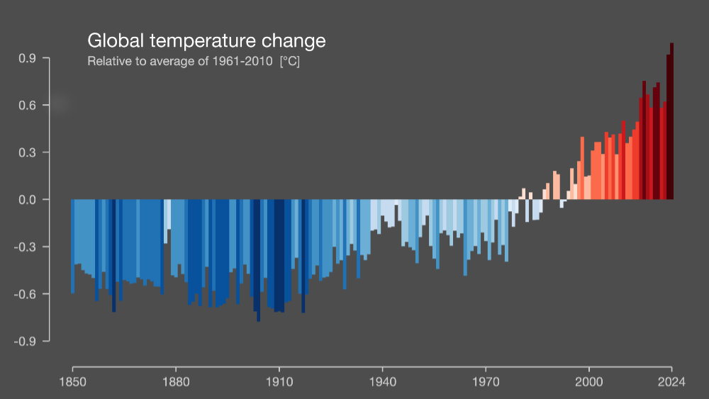
Our planet’s changing climate is largely responsible for the increase in frequency of wildfires, their intensity and duration. The excess CO2 in the atmosphere leads to hotter temperatures and reduced humidity, which increases the likelihood of devastating wildfires. The largest cause of greenhouse gasses is the burning of fossil fuels for energy consumption, and AI is energy hungry. Google’s own 2024 Environmental Report reflects this:
In 2023, our total GHG emissions were 14.3 million tCO2e, representing a 13% year-over-year increase and a 48% increase compared to our 2019 target base year. This result was primarily due to increases in data center energy consumption and supply chain emissions.
Google admits to struggling to control the emissions associated with AI:
As we further integrate AI into our products, reducing emissions may be challenging due to increasing energy demands from the greater intensity of AI compute, and the emissions associated with the expected increases in our technical infrastructure investment
FireSat’s slackline
The tragic irony of FireSat is that it is designed to save the same lives which are endangered by the AI GHG emissions which powers its AI system.

Google is keen to point out that FireSat is not only a tool for wildfire detection. Juliet Rothenberg, Google’s Product Director of Climate AI efforts at Google Research, told The Keyword:
“It’s also an incredible tool for reducing greenhouse gas emissions. It’s actually really beautiful that the constellation contributes to reducing climate change — while also responding to it.”
It’s a delicate tightrope to walk. FireSat can only be said to reduce climate change if the technology prevents more CO2 being released during wildfires, than it takes to run the project. Hopefully, as Google straps into cleaner energy sources, the environmental footprint of FireSat will improve.
Time will tell.
Related articles
About The Author

Lee Grant
NEXT UP